Kentucky Waterways Alliance
  • Home
  • Who We Are
    • Our Vision
    • History
    • Our Team
    • Our Board
    • Our Members
    • Annual Report and 990 Archive
    • Job Opportunities
  • What We Do
    • River Cowboys
    • Kentucky Watershed Network >
      • Watershed Grants
    • Protect >
      • Water Quality Standards
      • Co-Immunity Project
    • Watershed Planning
    • Restore >
      • Dam Removal
    • Cleanups
    • Certified Backyard Habitats
    • Clean Water Better Beer
    • Clean Water Better Bourbon
    • Clean Water Networking >
      • Maps
    • FAQ
  • Give
  • Events & News
    • Upcoming Events
    • Past Events >
      • 30th Anniversary Celebration
    • News
    • Ohio River: Endangered
  • Watershed Groups
    • Bacon Creek Watershed
    • Beargrass Creek Alliance
    • Darby Creek Watershed
    • Harrods Creek Watershed
    • Red River Watershed
    • Completed Watershed Plans
    • Salt River Watershed Watch
    • Green River Watershed Watch
  • Merchandise

​Outstanding National Resource Waters

Outstanding National Resource Waters (ONRWs) are waters that receive special protection against degradation under Kentucky’s water quality standards and the federal Clean Water Act. Waters eligible for ONRW designation include waters that are part of a national or state park, wildlife refuge or wilderness areas, special trout waters, waters with exceptional recreational or ecological significance, and high quality waters that have not been significantly modified by human activities.

In 2009, we worked with the US Forest Service and the Kentucky Division of Water to nominate four of the five new ONRW designated water bodies residing in the Daniel Boone National Forest. State law requires that the water quality in these water bodies be maintained and protected. This means that no new pollution is allowed into these waterways. The EPA’s final approval will increase Kentucky’s ONRW designated waters from 3 to 8 and will protect over 60 miles of streams and 2,000 acres of wetlands.
Picture
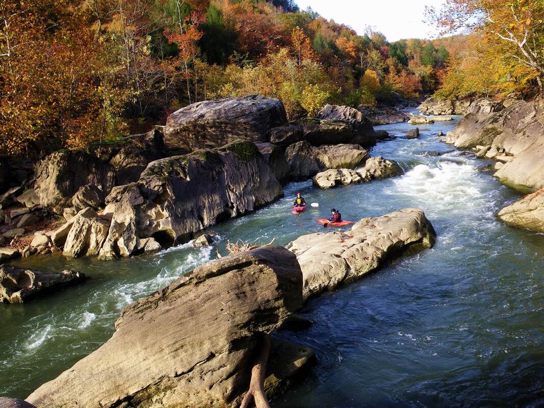
Photo Location: Rockcastle River, KY Credit: Brandon Jett
Outstanding National Resource Waters
  • Reelfoot Lake, Fulton County
  • Marsh Creek – McCreary County
  • Rock Creek – McCreary County
  • Rockcastle River – Border of Pulaski and Laurel Counties
  • War Fork – Jackson County
  • Red River Upstream – Menifee/Wolfe Counties
  • Underground River System Within Mammoth Cave National Park Boundary – Edmonson/Hart/Barren Counties
  • South Fork of Cumberland River – McCreary County

Follow KWA on Facebook

Kentucky Waterways Alliance

Get e-Notifications

Sign up now

Get in Touch

Have a question?
​Email us at [email protected]

Kentucky Waterways Alliance
330 North Hubbards Lane 
Louisville, KY 40207
(502) 589-8008
 View on a map

Follow Us

​Your privacy is important to us. We collect no information about you unless you choose to provide that information to us. We do not give, share, sell, or transfer personal information to third parties. To prevent unauthorized access, maintain accuracy, and ensure the correct use of information, we have appropriate physical, electronic, and managerial procedures to safeguard and secure information we collect. If you have questions about our privacy practices, you can contact us at the postal or email address posted on this site.
​©2020 Kentucky Waterways Alliance, Inc. All rights reserved.
  • Home
  • Who We Are
    • Our Vision
    • History
    • Our Team
    • Our Board
    • Our Members
    • Annual Report and 990 Archive
    • Job Opportunities
  • What We Do
    • River Cowboys
    • Kentucky Watershed Network >
      • Watershed Grants
    • Protect >
      • Water Quality Standards
      • Co-Immunity Project
    • Watershed Planning
    • Restore >
      • Dam Removal
    • Cleanups
    • Certified Backyard Habitats
    • Clean Water Better Beer
    • Clean Water Better Bourbon
    • Clean Water Networking >
      • Maps
    • FAQ
  • Give
  • Events & News
    • Upcoming Events
    • Past Events >
      • 30th Anniversary Celebration
    • News
    • Ohio River: Endangered
  • Watershed Groups
    • Bacon Creek Watershed
    • Beargrass Creek Alliance
    • Darby Creek Watershed
    • Harrods Creek Watershed
    • Red River Watershed
    • Completed Watershed Plans
    • Salt River Watershed Watch
    • Green River Watershed Watch
  • Merchandise