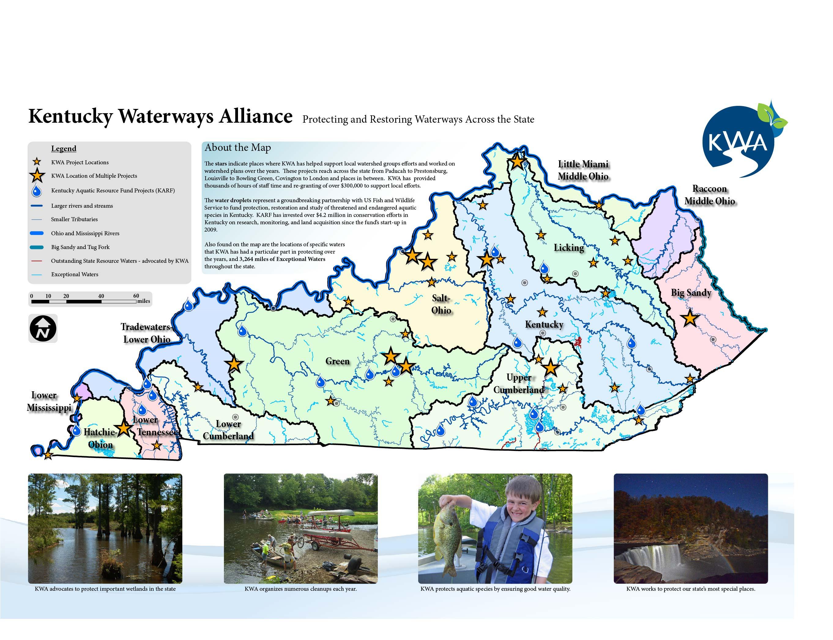
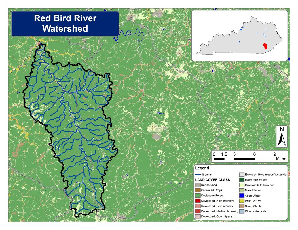
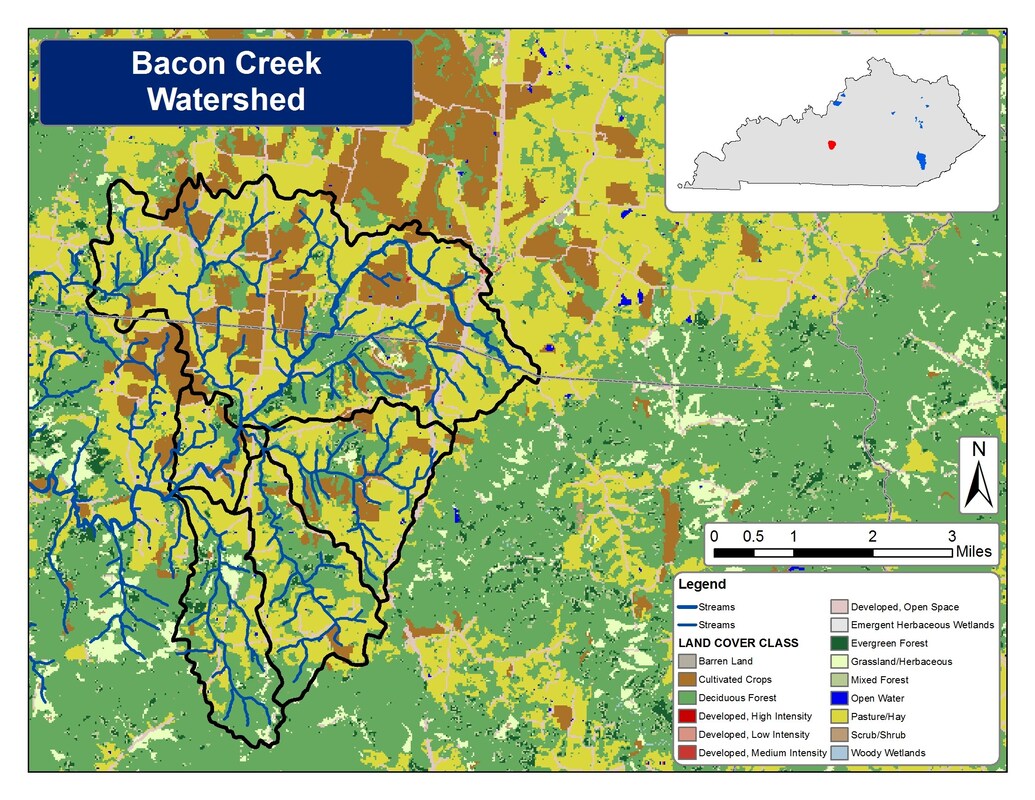
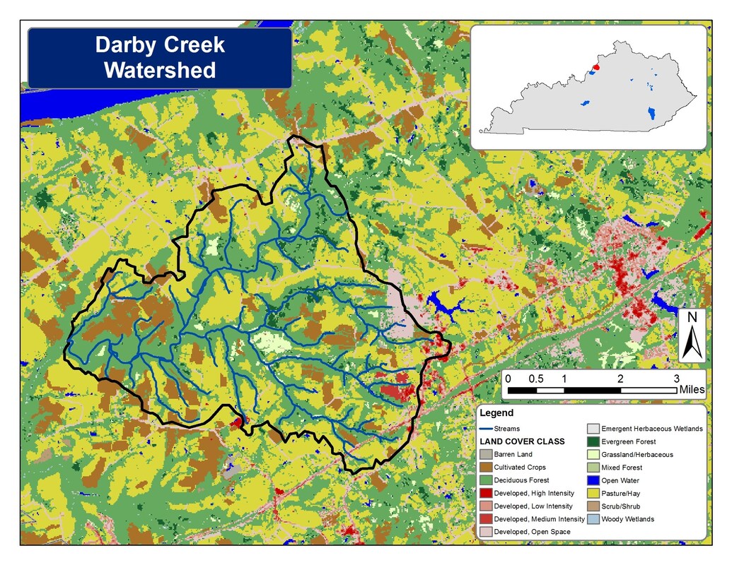
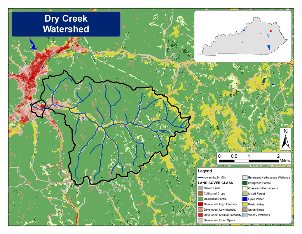
Kentucky Waterways Alliance
  • Home
  • Who We Are
    • Our Vision
    • History
    • Our Team
    • Our Board
    • Our Members
    • Annual Report and 990 Archive
    • Job Opportunities
  • What We Do
    • River Cowboys
    • Kentucky Watershed Network >
      • Watershed Grants
    • Protect >
      • Water Quality Standards
      • Co-Immunity Project
    • Watershed Planning
    • Restore >
      • Dam Removal
    • Cleanups
    • Certified Backyard Habitats
    • Clean Water Better Beer
    • Clean Water Better Bourbon
    • Clean Water Networking >
      • Maps
    • FAQ
  • Give
  • Events & News
    • Upcoming Events
    • Past Events >
      • 30th Anniversary Celebration
    • News
    • Ohio River: Endangered
  • Watershed Groups
    • Bacon Creek Watershed
    • Beargrass Creek Alliance
    • Darby Creek Watershed
    • Harrods Creek Watershed
    • Red River Watershed
    • Completed Watershed Plans
    • Salt River Watershed Watch
    • Green River Watershed Watch

Maps

Maps

We’re big on visuals and maps, and wanted to provide all our members and the public access to some of the data we track on a daily basis, as well as access to maps that show what we do and where we do it!

​Check out the different categories of maps below–click on any image for a larger version!
Picture
State_display_map_final_24x36
Picture
Central Bluegrass Land Use and Streams
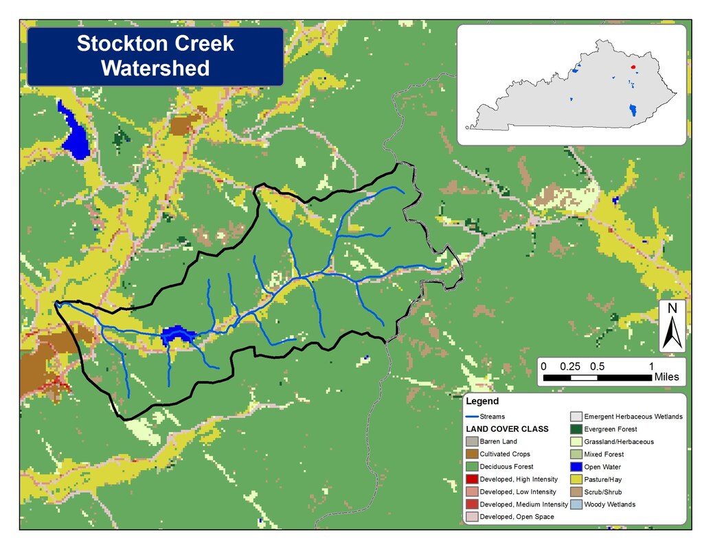
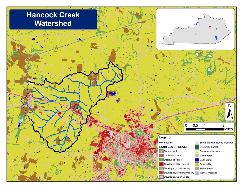
Current Watershed Planning Project Locations
Picture
Picture
Picture
Picture
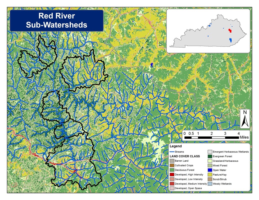
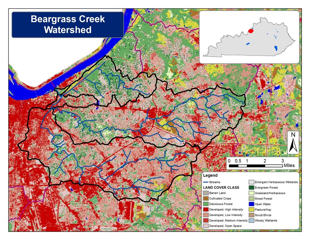
Completed Watershed Planning Projects
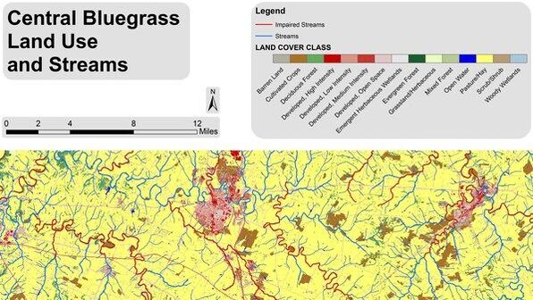
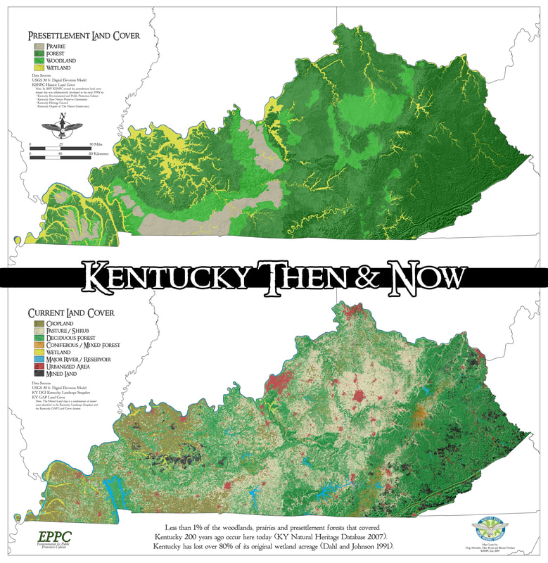
Picture
Picture
Picture
Picture

​Maps from Partners

PDF maps by the Kentucky State Nature Preserves Commission, showing the change from Pre-Settlement Land Cover to the Current Land Cover in Kentucky (​KY_ThenAndNow)
Picture
Kentucky Wetlands Inventory – US Fish & Wildlife Services (Google Earth File)
Picture

Facilities within 10 miles of the Ohio River releasing more than 10K pounds of toxing into surface waters

Follow KWA on Facebook

Kentucky Waterways Alliance

Get e-Notifications

Sign up now

Get in Touch

Have a question?
​Email us at [email protected]

Kentucky Waterways Alliance
330 North Hubbards Lane 
Louisville, KY 40207
(502) 589-8008
 View on a map

Follow Us

​Your privacy is important to us. We collect no information about you unless you choose to provide that information to us. We do not give, share, sell, or transfer personal information to third parties. To prevent unauthorized access, maintain accuracy, and ensure the correct use of information, we have appropriate physical, electronic, and managerial procedures to safeguard and secure information we collect. If you have questions about our privacy practices, you can contact us at the postal or email address posted on this site.
​©2020 Kentucky Waterways Alliance, Inc. All rights reserved.
  • Home
  • Who We Are
    • Our Vision
    • History
    • Our Team
    • Our Board
    • Our Members
    • Annual Report and 990 Archive
    • Job Opportunities
  • What We Do
    • River Cowboys
    • Kentucky Watershed Network >
      • Watershed Grants
    • Protect >
      • Water Quality Standards
      • Co-Immunity Project
    • Watershed Planning
    • Restore >
      • Dam Removal
    • Cleanups
    • Certified Backyard Habitats
    • Clean Water Better Beer
    • Clean Water Better Bourbon
    • Clean Water Networking >
      • Maps
    • FAQ
  • Give
  • Events & News
    • Upcoming Events
    • Past Events >
      • 30th Anniversary Celebration
    • News
    • Ohio River: Endangered
  • Watershed Groups
    • Bacon Creek Watershed
    • Beargrass Creek Alliance
    • Darby Creek Watershed
    • Harrods Creek Watershed
    • Red River Watershed
    • Completed Watershed Plans
    • Salt River Watershed Watch
    • Green River Watershed Watch